ModelContextProtocol (MCP) Server Integration
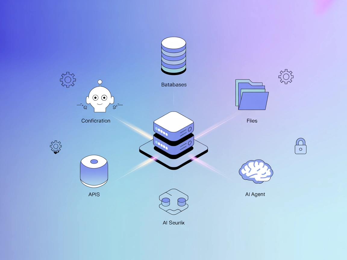
The ModelContextProtocol (MCP) Server acts as a bridge between AI agents and external data sources, APIs, and services, enabling FlowHunt users to build context...
4 min read
AI
Integration
+4

Connect QGIS Desktop with LLMs for powerful, AI-assisted geospatial workflows—automate projects, layers, algorithms, and Python scripting through FlowHunt’s MCP component.
FlowHunt provides an additional security layer between your internal systems and AI tools, giving you granular control over which tools are accessible from your MCP servers. MCP servers hosted in our infrastructure can be seamlessly integrated with FlowHunt's chatbot as well as popular AI platforms like ChatGPT, Claude, and various AI editors.
The QGIS MCP Server is a Model Context Protocol (MCP) implementation that bridges QGIS Desktop with large language models (LLMs), such as Claude. By leveraging a socket-based server and the QGIS MCP plugin, it enables AI assistants to directly control and interact with QGIS projects. This allows AI-driven automation of tasks like project creation, layer manipulation, algorithm execution via the Processing Toolbox, and even direct Python code execution within QGIS. The server is designed to streamline geospatial workflows, facilitate advanced data processing, and enhance developer productivity by enabling seamless, prompt-assisted management of QGIS from an LLM client.
No explicit prompt templates are mentioned in the repository.
Start your free trial today and see results within days.
No explicit MCP resources are described in the repository.
Get latest tips, trends, and deals for free.
No setup instructions found for Windsurf.
git clone git@github.com:jjsantos01/qgis_mcp.git
qgis_mcp_plugin folder to your QGIS profile plugins folder (see README.md
for platform-specific locations).Claude > Settings > Developer > Edit Config > claude_desktop_config.json.mcpServers:{
"mcpServers": {
"qgis": {
"command": "uv",
"args": [
"--directory",
"/ABSOLUTE/PATH/TO/PARENT/REPO/FOLDER/qgis_mcp/src/qgis_mcp",
"run",
"qgis_mcp_server.py"
]
}
}
}
No API or environment variable usage for keys is described in the repo.
No setup instructions found for Cursor.
No setup instructions found for Cline.
Using MCP in FlowHunt
To integrate MCP servers into your FlowHunt workflow, start by adding the MCP component to your flow and connecting it to your AI agent:
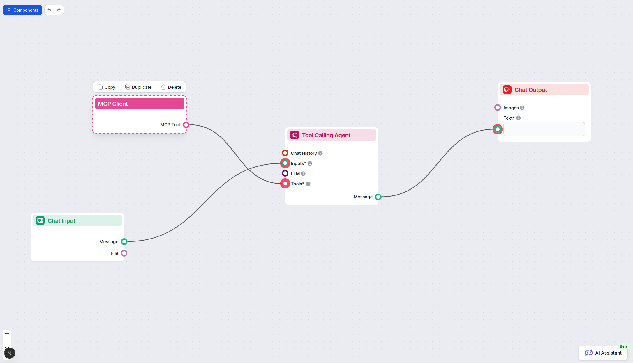
Click on the MCP component to open the configuration panel. In the system MCP configuration section, insert your MCP server details using this JSON format:
{
  "qgis": {
    "transport": "streamable_http",
    "url": "https://yourmcpserver.example/pathtothemcp/url"
  }
}
Once configured, the AI agent is now able to use this MCP as a tool with access to all its functions and capabilities. Remember to change “qgis” to whatever the actual name of your MCP server is and replace the URL with your own MCP server URL.
| Section | Availability | Details/Notes |
|---|---|---|
| Overview | ✅ | Clear description of QGIS MCP Server in README.md |
| List of Prompts | ⛔ | No prompt templates mentioned |
| List of Resources | ⛔ | No explicit MCP resources found |
| List of Tools | ✅ | Described in README.md (project/layer manipulation, processing, code execution) |
| Securing API Keys | ⛔ | No API key/environment variable info |
| Sampling Support (less important in evaluation) | ⛔ | Not mentioned |
Between the two tables, the QGIS MCP Server is well-documented in terms of core features and tool exposure, but lacks explicit prompt/resource listings and does not cover API key security or sampling/roots support. I’d rate it a 6/10 for MCP completeness and developer readiness.
| Has a LICENSE | ⛔ (not found) |
|---|---|
| Has at least one tool | ✅ |
| Number of Forks | 68 |
| Number of Stars | 540 |
The QGIS MCP Server is a bridge between QGIS Desktop and large language models (LLMs), allowing AI agents to automate and control QGIS projects, layers, algorithms, and even execute Python code from conversational interfaces.
AI agents can create, load, and save projects; add or remove vector/raster layers; execute QGIS processing algorithms; and run Python scripts directly within QGIS.
Code execution is powerful but should be used with caution to avoid running untrusted or harmful scripts in the QGIS environment.
Add the MCP component in your FlowHunt flow and configure it with your QGIS MCP Server details. Use the JSON format provided in the documentation to specify the server's URL and transport method.
No API keys or environment variables are required based on the available documentation.
Automated project setup, geospatial data layer management, batch processing of algorithms, AI-driven spatial analysis, and custom Python scripting within QGIS via LLM requests.
Automate your geospatial workflows and empower AI agents to control QGIS Desktop via the QGIS MCP Server. Try it with FlowHunt’s platform today.
The ModelContextProtocol (MCP) Server acts as a bridge between AI agents and external data sources, APIs, and services, enabling FlowHunt users to build context...
The LLM Context MCP Server bridges AI assistants with external code and text projects, enabling context-aware workflows for code review, documentation generatio...

The Quarkus MCP Server enables FlowHunt users to connect LLM-powered agents to external databases and services via Java-based MCP servers, streamlining automati...
Cookie Consent
We use cookies to enhance your browsing experience and analyze our traffic. See our privacy policy.